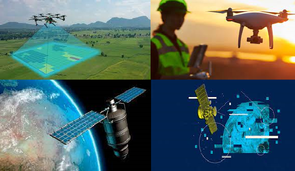
OUR SERVICES INCLUDE:
- Drone Mapping & Surveys
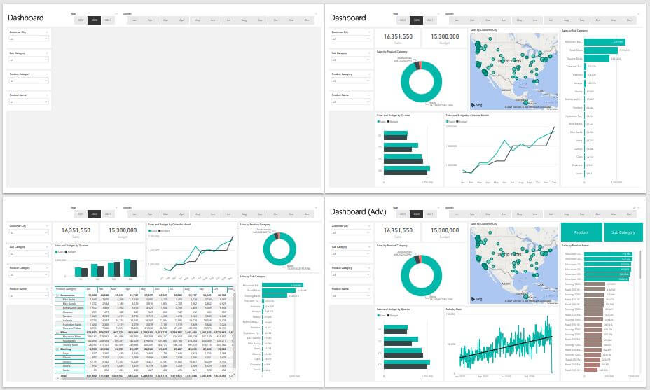
- Geospatial Intelligence
- Spatial Data Analytics & Modelling

We are channeling products and services with the optimal innovation to improve African data collection across scales.
Kartgis Geospatial Solution, an indigenous Geospatial Services and Drone Mapping company. We believe in the potential of geospatial and allied technologies and leverage them to solve development problems. We ease the data gap by providing professional services in Drone Mapping, Geospatial Intelligence, Satellite image acquisition and Analysis, Spatial Data Infrastructure, Data Collection, Analysis and Insights, Spatial Data Analytics and Modelling, Business Intelligence and Market Fit Analysis among other applications.
To enable effective and efficient decision making with respect to planning, design and urban development via access to real time data solutions.
Our Mission is to provide novel and innovative solutions using drones, GIS and Artificial Intelligence in data collection, analysis and visualization.
We understand that acquiring detailed, accurate and reliable data for planning has remained exclusive in the urban development and planning sphere.
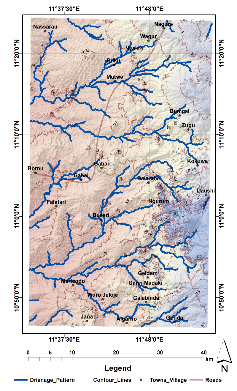
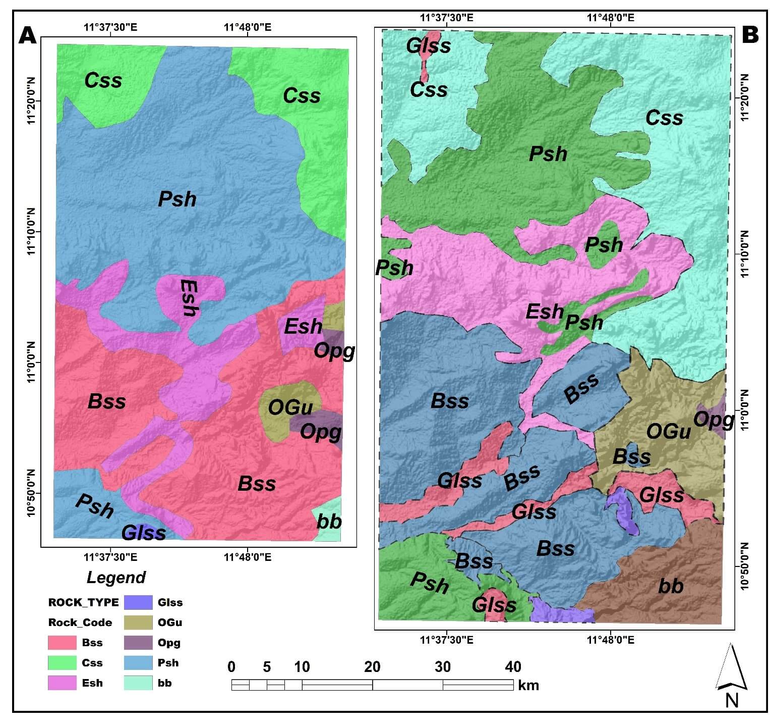
Our company has expert experience in satellite image acquisition using remote sources
We deliver innovative solutions that are cost effective and efficient to meet the needs of our clients..
With Razor Sharp, Laser Guided Focus! We connect Organizations, Governments, Businesses and Decision Makers to an incredible world of DATA and SOLUTIONS.
With novel products in Civil Engineering, transportation, Planning & Telecoms among others, Kartgis Geospatial Solution cons.
"[...] Abodunrin Amos, the CE0 of Kartgis Geospatial Solution is an Intelligent fellow, Hardworking and a goal getter. He handles all tasks with a level of importance comparable to none. He is eloquent and works perfectly with deadline. He is a good analyst, with a very good data interpretation skill."

"Amos is great Geospatial data analyst, hardworking, skillful and result oriented. We had the opportunity to work on several projects over the years and his impacts and contributions could not be overemphasized. [...] I thus highly recommend him for any work concering analysis of spaitial & huge data sets."

"Amos has taught me everything I know about data visualization! He taught my group how to display data in clever ways. Also, he is a super-fast and efficient Analyst. very dedicated and committed to accomplishing assigned tasks. He is a super-bright guy – I can highly recommend him!"

Lorem ipsum dolor sit amet consectetur adipisicing elit. Saepe asperiores adipisci doloremque odio quod? Lorem ipsum dolor sit amet consectetur adipisicing elit. Saepe asperiores adipisci doloremque odio quod,adipisicing elit. Saepe asperiores adipisci doloremque odio quod?..


Lorem ipsum dolor sit amet, consectetur adipisicing elit. Nobis sapiente
info@consectetur.com
09010000000